Supporting Indigenous river monitoring and restoration in New Brunswick
This is part of a blog series highlighting how water data is being put to use to protect freshwater
“Oh!” says Alexa Meyer as she stands on the banks of the Skutik (St. Croix) River on a cool October day. “A big eel!”
It’s a sight worth celebrating. Meyer manages aquatic conservation for the Passamaquoddy Recognition Group Inc. (PRGI), an Indigenous-led not-for-profit that represents the interests of the Peskotomuhkati Nation at Skutik. And one of their goals is increasing the presence of eels, alewives, blueback herring and other native fish the Nation has traditionally relied on.
For millennia, the Peskotomuhkati have inhabited a big chunk of what’s now southwestern New Brunswick, stretching from Spednic Lake south of Canterbury to Passamaquoddy Bay. It’s an area that encompasses 11 watersheds, including the Skutik.
Today, those watersheds face numerous threats from dams, deforestation, rising temperatures and other human pressures. And that means fewer fish. So, in 2019, the Nation developed a restoration plan for the Skutik watershed. “We are looking to restore as closely as now possible to how the Peskotomuhkati lived in the territory pre-contact,” explains Meyer.
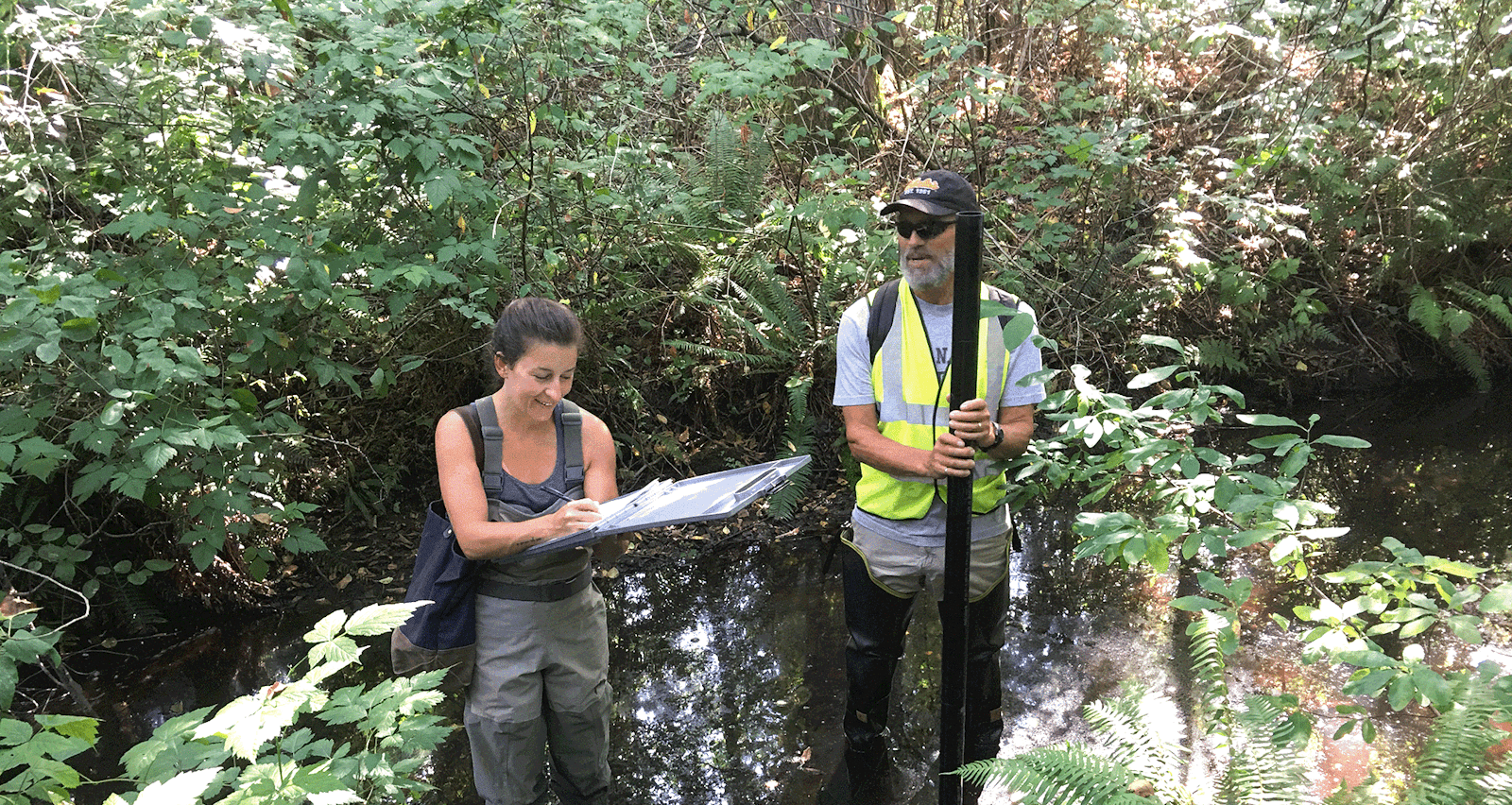
Brian Hartford, Water Quality Coordinator at PRGI taking Water Quality in the Skutik River. Credit: PGRI.
Smart restoration starts with good data
To guide that work, PRGI needed water quality data. They turned to Atlantic DataStream, an open access online platform for sharing water and sediment quality data. Since its launch in 2018, Atlantic DataStream now brings together data collected by 100+ monitoring groups throughout Atlantic Canada.
As a result, PRGI was able to see which groups were monitoring watersheds within Peskotomuhkati territory and pinpoint areas with the poorest water quality. They could also identify the areas that lacked data. With these insights, PRGI launched an ambitious program to start tracking water quality at more than 80 data-deficient sites.
Each month, Meyer and her team use handheld probes to monitor dissolved oxygen, salinity, pH, and other parameters at each site. They’ve also installed temperature loggers to track warming trends. If results are poor, they send samples to a lab for more extensive analysis.
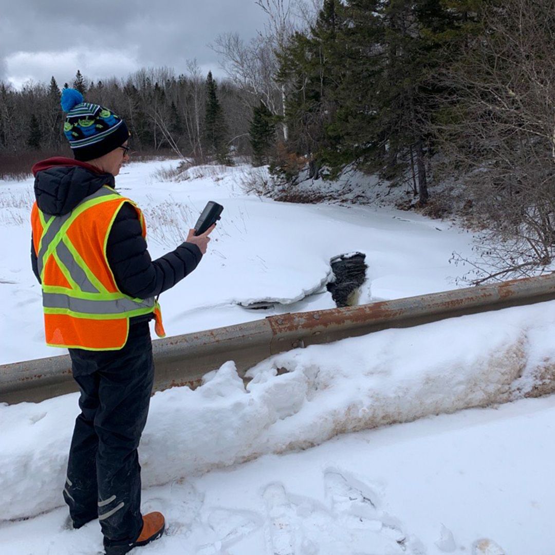
Bex Goreham, PRGI Environmental Technologist, taking water quality at one of the monthly sites. Credit: PGRI.
Helping rivers be rivers again
That data has helped PRGI launch a variety of targeted restoration projects. In 2021, for example, they removed collapsed culverts and other structures blocking fish passage, opening up more than eight kilometres of stream.
“Pulling out [those obstacles] restores water flow, allows fish back into that habitat, brings in more oxygen, and prevents excessive sediment blockages,” Meyer explains.
They also planted trees to help stabilize 700 metres of riverbanks where there were problems with erosion and sedimentation.
“We’re trying our best to improve habitat for fish and take an ecosystem approach as well, thinking about all other creatures that live in this area,” says Meyer. And they’re not doing it alone, she adds, pointing to collaborations with other watershed groups identified through DataStream.
Those collective efforts are already making a difference at restoration sites. “The river is allowed to be a river again,” says Meyer. But that’s just the beginning. Guided by good data, she’s looking forward to seeing even bigger wins — and more eels, trout and other native fish — in the coming years.
View Dataset