How is data on DataStream being used?
More and more people are using data on DataStream to uncover meaningful insights about the health of their watersheds. The case studies below highlight just a few of the ways water data is being put to use to protect freshwater.
Have a good data use case study? We'd love to hear it!
Policy and regulatory
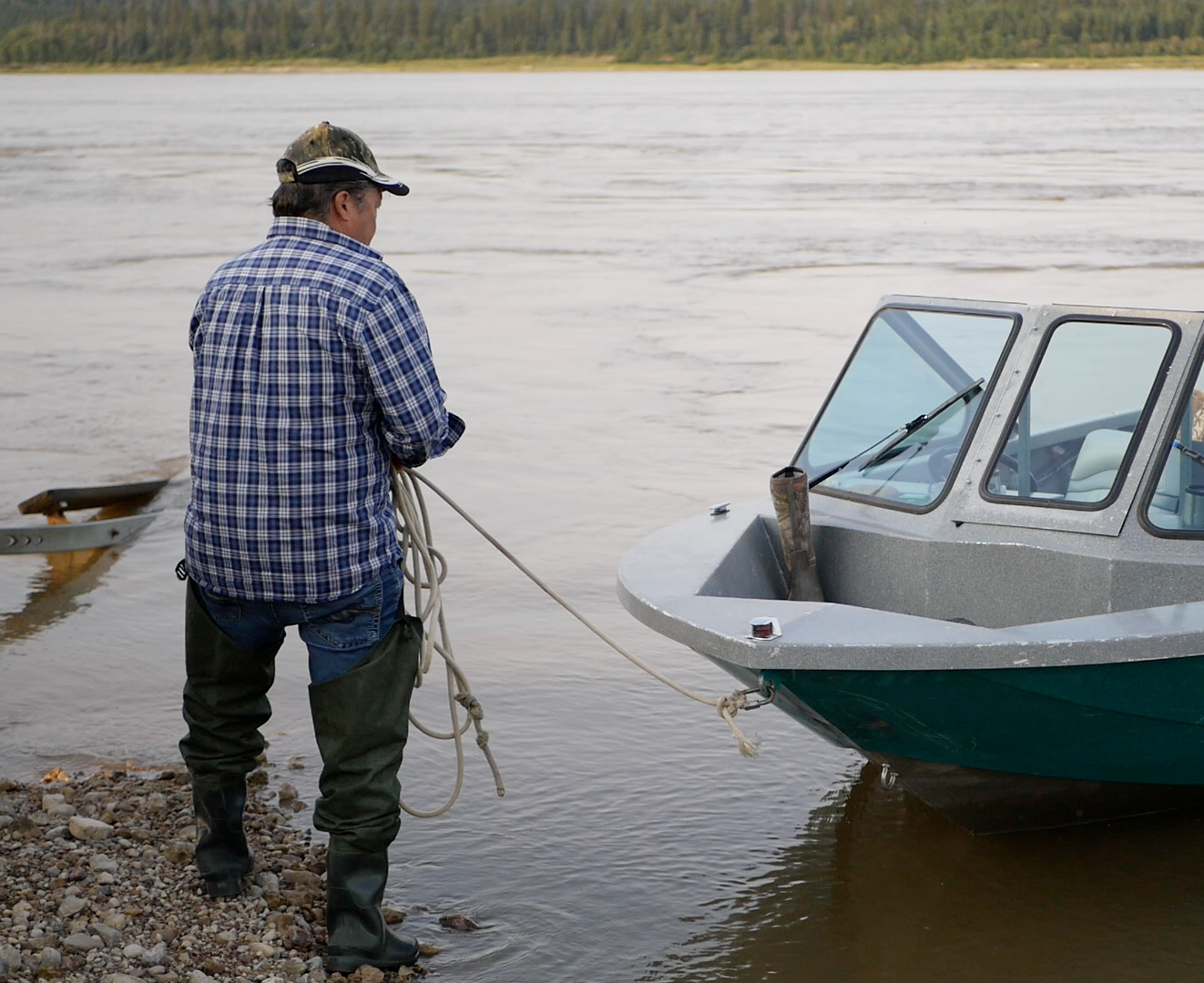
Pipeline Installation and repair in the Northwest Territories
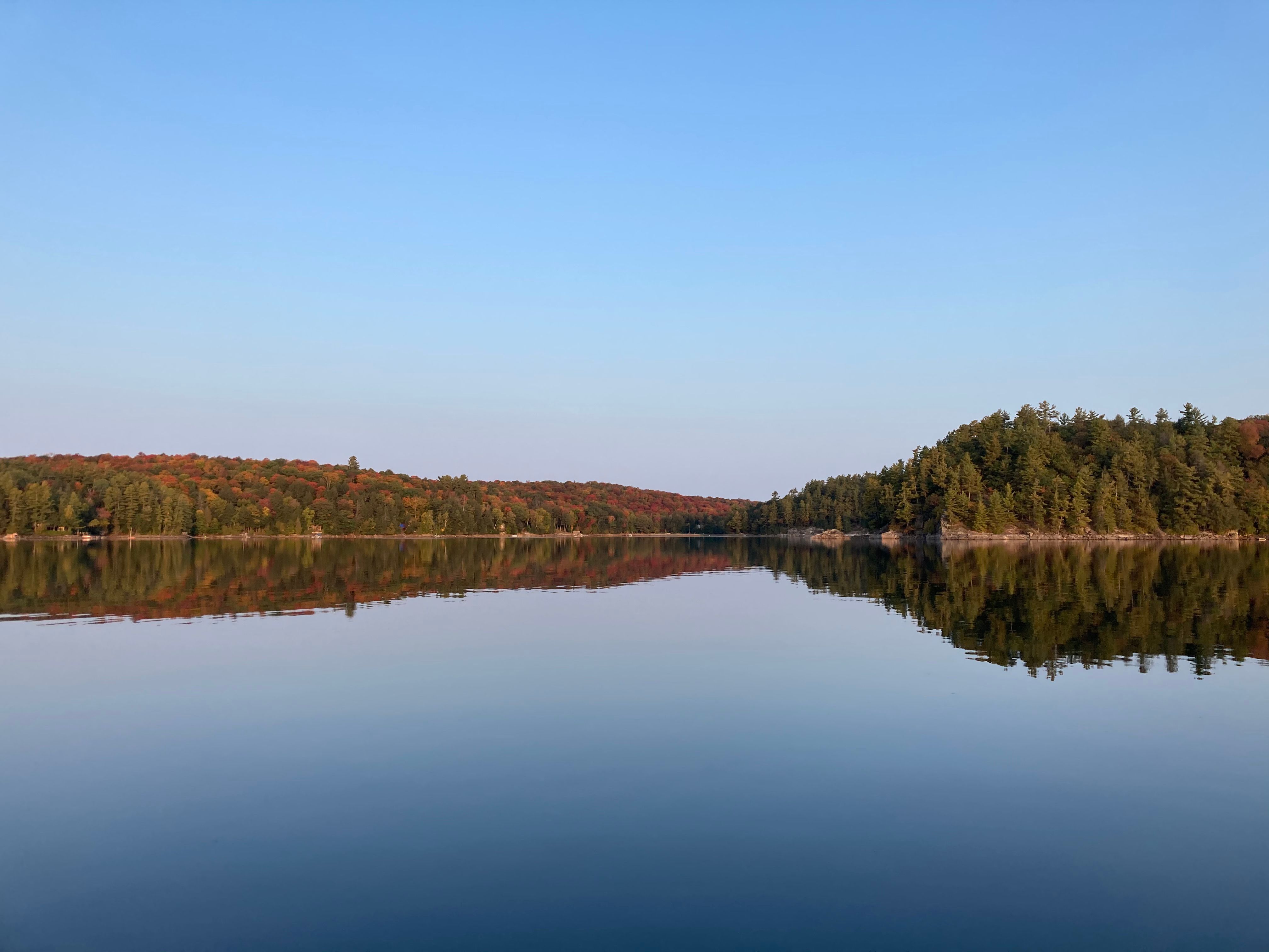
DataStream facilitated the use of community-based monitoring data in a public hearing for the replacement of a pipeline beneath the Mackenzie River in a remote area of the Northwest Territories. DataStream allowed regulators to use community generated data to set spatially appropriate triggers for turbidity generated by this project. If this community data had not been available, regulators would have had to use data from a federal monitoring site at a great distance from the proposed project. The Mackenzie River (or Dehcho) is central to the lives and culture of the Dehcho First Nations.
Watershed assessment
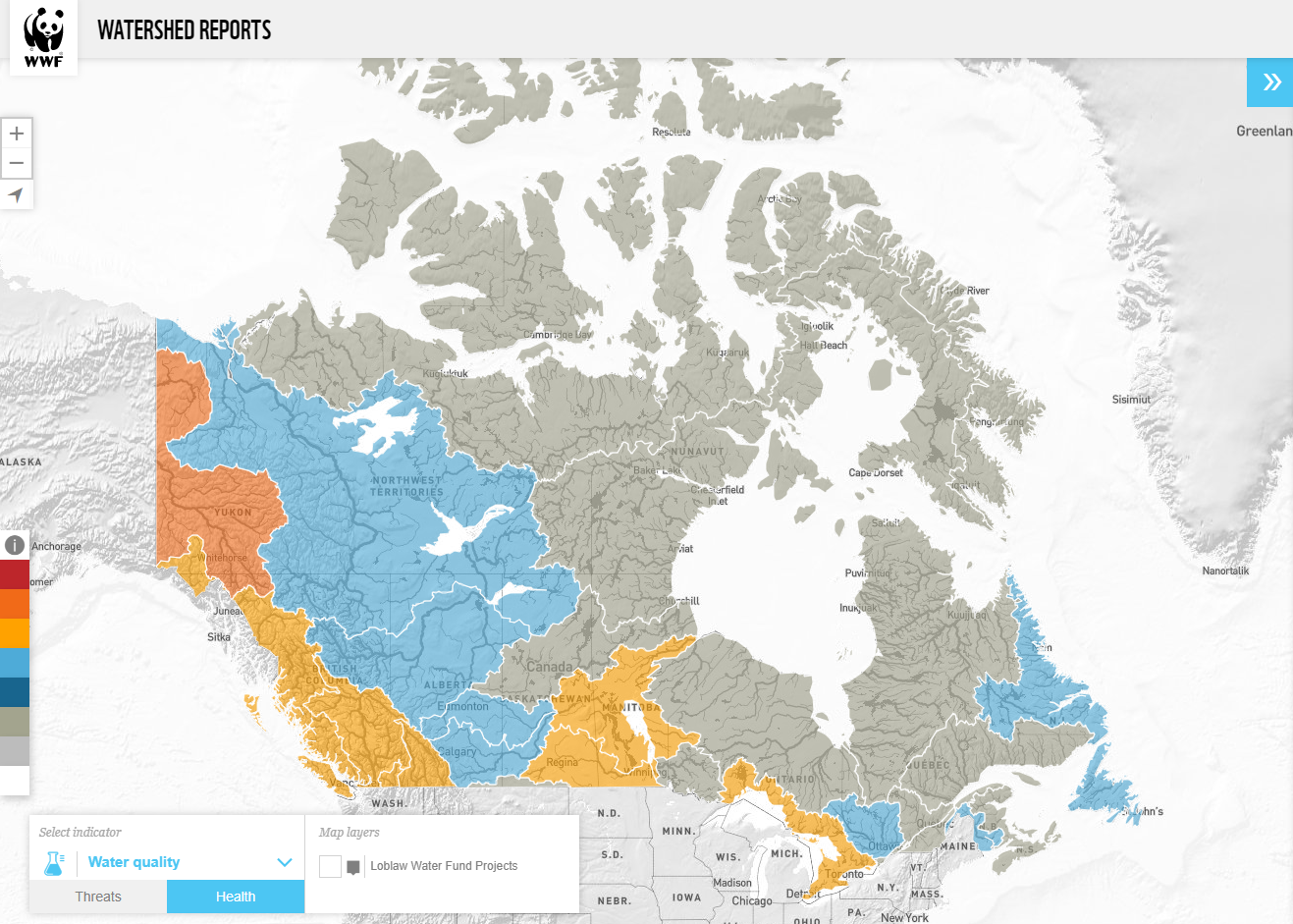
Watershed Reports
WWF-Canada's Watershed Reports (published in 2017 and 2020 were the first-ever national-scale assessments on the health and threats to freshwater in Canada. WWF-Canada used DataStream data to arrive at many of the health scores and stated that DataStream greatly reduced the effort needed to assemble this information.
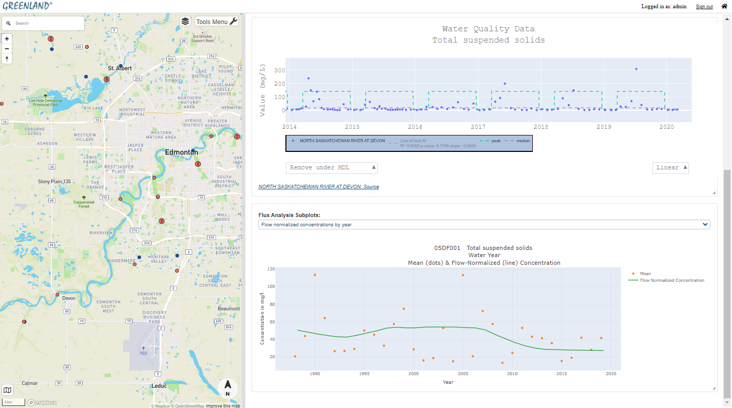
THREATS – The Healthy Rivers Ecosystem AssessmenT System
The THREATS modelling tool incorporates DataStream data to analyze trends in water quality, flow and climate. THREATS is used by companies such as EPCOR utilities (Edmonton Power Corporation), allowing industry, land developers, and government agencies to include advanced predictive models in their decision-making processes.
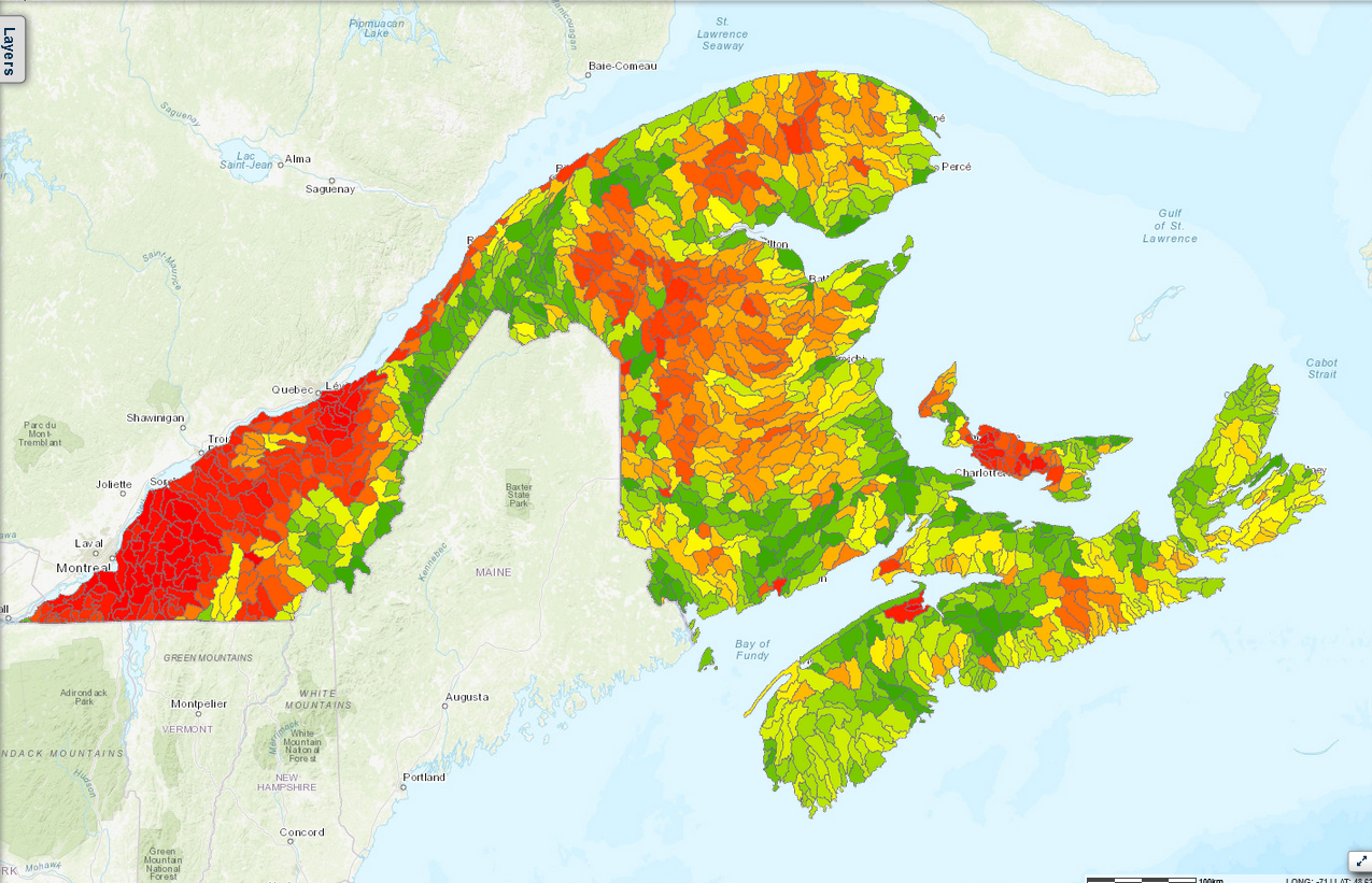
Freshwater Conservation Blueprint
The Freshwater Conservation Blueprint is a collection of geo-spatial tools designed to support freshwater conservation planning in the Northern Appalachian-Acadian Region of Canada, an area spanning the Maritimes and Eastern Quebec.
Program design
Monitoring the Peace-Athabasca Delta and Wood Buffalo National Park
The new Indigenous-led Nipîy Tu Research and Knowledge Centre (NTKRC) aims to develop a coordinated and comprehensive approach to research by connecting data across different systems, particularly data from oil sands monitoring programs. Water quality data collected by participating community-based monitoring programs is stored on DataStream where it can be accessed to support evidence-based decision making in support of corrective actions in the Peace Athabasca Delta.
Long-term water quality monitoring
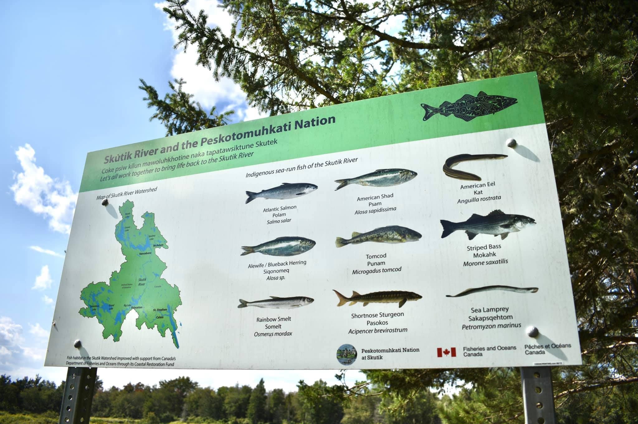
Passamaquoddy Recognition Group Inc. (PRGI) is an Indigenous organization in New Brunswick representing the interests of the Passmaquoddy People (known in their language as Peskotomuhkati). In developing their long-term water quality monitoring program, PRGI used DataStream to avoid duplication of efforts, fill known data gaps, and advance collaborative water stewardship by connecting with other water initiatives in the region.
Data sufficiency analysis
Atlantic Water Network developed a data sufficiency analysis tool to help guide the work of their network of 70+ water monitoring groups. This included identifying where significant amounts of data already exist to answer local questions as well as where more monitoring is needed.
Research and reporting
Tracking microbial contamination in coastal waters
Researchers at the Douglas Campbell Lab are looking at decades-worth of microbial water quality data to analyze patterns of fecal contamination along the Northumberland Strait. The data – collected by diverse New Brunswick watershed groups and government agencies – and the lab’s findings can help shape strategic coastal zone management decisions.

Road salt pollution in Canada
A CTV journalist exploring the impacts of road salt pollution on waterways in Canada encountered an unexpected roadblock in their research: despite the widespread use of road salts across the country, chloride data is sparse and difficult to find. After learning about DataStream, the journalist was able to access the information they needed for the investigation.
POSEIDON (in development)
POSEIDON is an innovative water quality portal that will harness machine learning and AI to revolutionize how we monitor stream nutrient levels, loads, and landscape inputs. Once completed, it will provide crucial insights needed to drive conservation efforts.
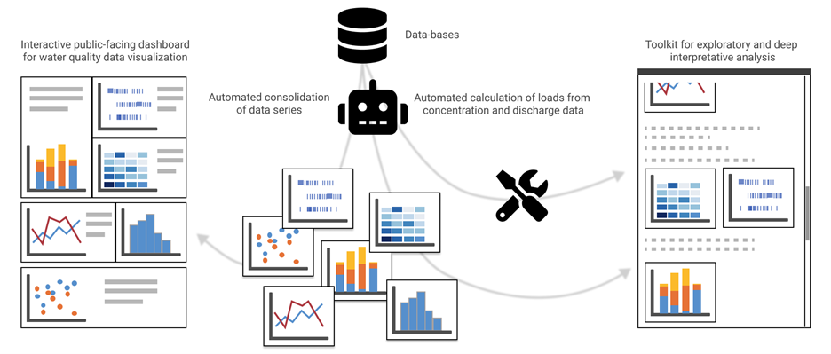
CLAWAVE (in development)
The Ecohydrology group’s CLAWAVE project (Chemical Load Assessments for Watersheds: Automation and Visualization Experience) will develop and apply new methods to extract, treat and visualize various water quality indicators at the watershed scale.